
Click on map for full resolution
We’ve divided the Buttonwood and Bluegrass area into two main sections. This first section discusses the area downstream from the 475 bridge area on the south side of the river which is called Buttonwood Park. The second section is across the river and called the Bluegrass Island area.
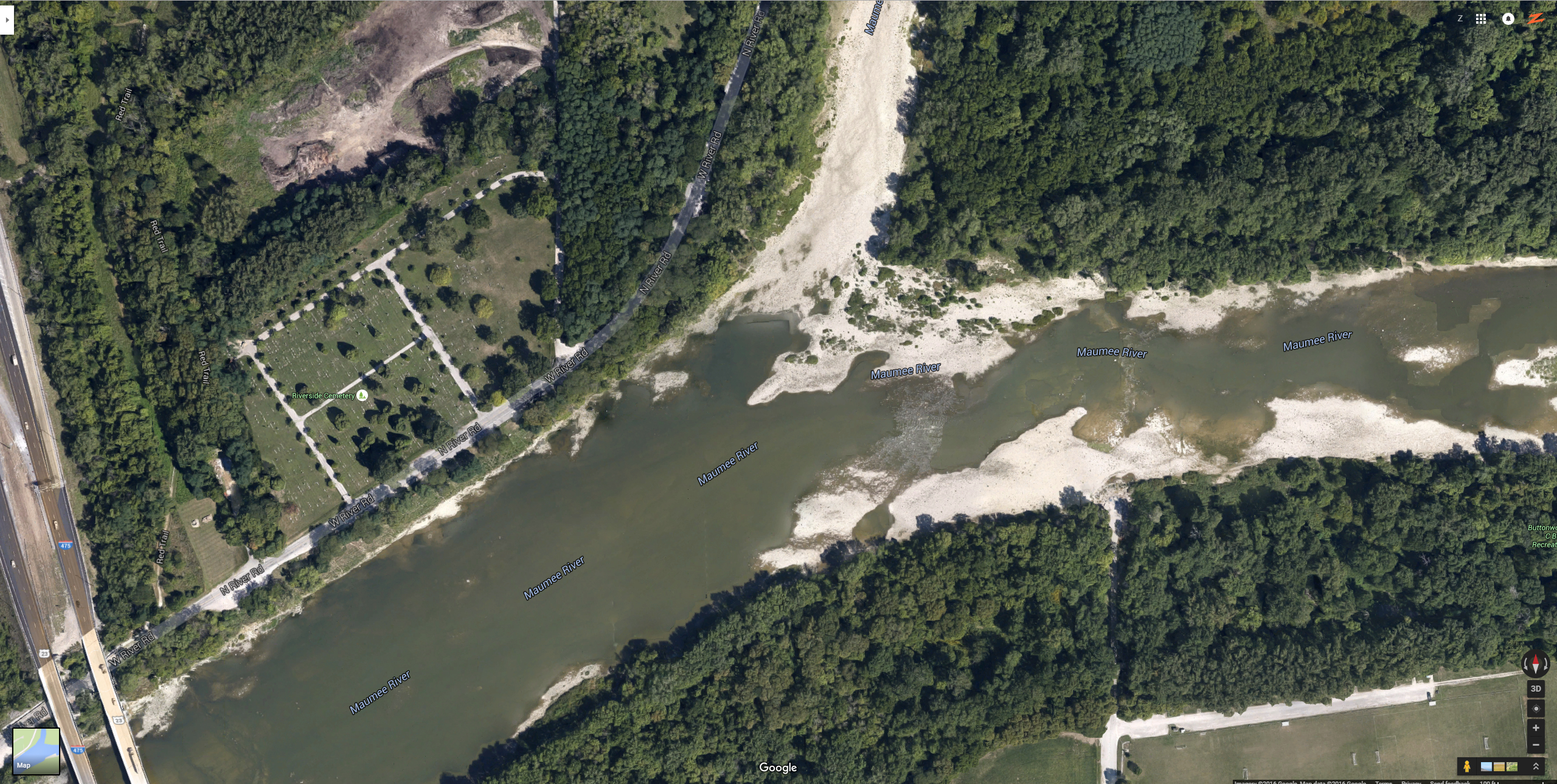
Across from Sidecut Park and the 475 Bridge area, on the south side, is Buttonwood Park area.
As you can see, almost that entire stretch from the bridge to Buttonwood is one depth and one elevation. There are some shallower areas on the north side, in Sidecut Park still, but that majority of the south side in Buttonwood is one deep channel with a very flat rock bottom.
You can usually access most of this area from shore if you want. Cast far, let it drift downstream, and keep your eye on your pole for bites. If you got one, set your hook and
retrieve quickly. Keep your weight on the bottom and feel the bottom. If your weight isn’t drifting downstream, use lighter weights.
You can wade in this area, but as you can see, the depth drops off quickly and you can’t venture too far. Especially, if the water level is high. This picture was taken during a drought, and there is still plenty of depth and plenty of water.
In that middle section, where the river forks, you do see a nice rock shelf on the Buttonwood side that you can wade onto, and that may give you access to more of the river
width and that nice deep channel.
The river here (before the fork) is about 200 yards across and the current and flow usually drop compared to the Jerome and 475 bridge area.
Buttonwood can be fished even when the water level is lower (below 582).
Keep our maps loaded up on your phone to check!