
In this next section, we will generally be showing a detailed map of each location along with ways to access and fish that location. This
website is always up to date. As of March 2018, this is the most current and accurate information we have.
The Big Map
This is the 4 mile stretch where 99% of walleye fishing on the Maumee River occurs. Use this map for reference, the other maps are more detailed and zoomed in version of this
main map. The most important areas have been highlighted on this large map. The two big lines are the boundaries of where the fishing occurs.
All of these maps are oriented so that the you view them from the side. The middle seam of this book is South. The outer left corner is North. Please turn the book clockwise 90
degrees to view the maps.
We continue to add more photos and more maps and locations to our website and Facebook page daily, so check often for updates. See the resources section in the back for
addresses.
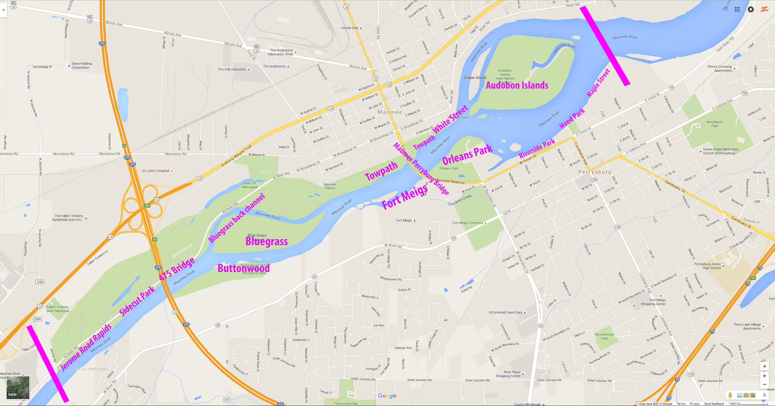
This is our big map of all the various fishing locations on the Maumee River highlighted in purple. More areas are added every day, so check back often. Click on the map to see a bigger version of it.
Click under “Maps” in the menu to read details about each section and see our incredible drought year archived maps of the river floor. You can see all the deep channels and holes where walleye like to hide.
Water Levels
When the water level is low (582 feet above sea level and lower), fishing anything downstream of the Maumee Perrysburg Bridge is not going to be as productive. You need to be on the other side of the bridge (further upstream). Areas that are productive when the water level is low are Jerome Rapids all the way downstream to the Fort Meigs and Towpath/Sidecut area across from Fort Meigs.
When the water level is high (583+) almost all areas work, including downstream of the bridge. When the water is high, you have lots of flow and lots of current. You should be careful where you wade and how you wade. Walleye like to stay in the current, but when it’s that high and fast, they like hide out in areas where the current breaks. You will see fast flowing water, next to an eddy or a slow moving area, you need to fish along those line. And any deep holes or crevices, they hide in there as well.